The London City Race Weekend 2025 was once again hosted in the area of Rotherhithe. 913 participants signed up to compete in the race this year, hosted by South London Orienteers.
This year saw the 16th running of the London City Race. Since its conception, it has grown to be the largest annual Urban event in the country, with over 900 competitors taking part this year. At the same time, the format has expanded into a three-event weekend which brings participants from across the UK and Europe year after year to compete and discover hidden corners of the capital.
Gordon, you were this year’s Planner – tell us more about the lead-up to and during the event. Include details of how far in advance planning began, and if there were any challenges and limitations.
Our original plan was to hold the event in Wapping. We had identified a new area we could add to the original Wapping map. I examined that area in late 2024 and it looked like it would be a good addition to the map. The local council was approached and after getting positive indications from the council we arranged for our mapper, Don McKerrow, to map this addition for inclusion in the original Wapping map. During the Spring and early Summer 2025, I spent many days checking the rest of the map, identifying possible legs and usable control sites and starting to develop possible course shapes. Andrew had already arranged a venue, and detailed work had been carried out to ensure that venue worked and would provide safe courses for the junior and children’s courses with close starts and finishes.
However, we struggled to get sufficient permission to use the area and by late July we were left in the position where there was too high a risk that the event might not happen.
We then decided that the best course of action was to revert to Rotherhithe, which we last used in 2023. We received overnight approval from Southwark Council to use the roads, parks and housing managed by them – at this stage we were only seven weeks from the event. However, I knew the map would need updating before I could do much planning. I spent several weeks doing a full resurvey of the area in early August to provide Don with all the changes required to the map. As for any urban area change is a regular feature!
By late August, I had identified a range of potential legs and control sites, the challenge always being how to secure the control – inevitably this involved many iterations as control sites were not always available in the desired location thus impacting the quality of the leg. As with any urban event, we had to carry out a lot of checks on ownership of roads and estates to ensure we did not impinge on any private areas as we wanted to ensure we are always welcome to return. A significant number of roads and estates were privately owned thus restricting the scope for locating controls and given the short timescale available, it was not realistic to seek permission for a multitude of small areas. I managed to track down various maps and documents with Southwark Council which helped in working out the ownership of roads, parks and housing – really useful tools to ensure we did not cause issues with local residents and the public.
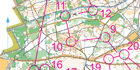
The basic aim of my planning was to avoid similar legs to our event here two years ago and yet get a range of long and short legs designed which created route choice challenges or cost time penalties for not closely reading the map. This was less easy to achieve in the southern part of the area visited by courses 1-3. I adjusted the lengths of some courses to try and get closer to targets this year – overall, the leading times were close to our anticipated wining times.
By late August courses were in a good shape and were sent to our controller, Helen Marsden. This only gave Helen a couple of weeks to review the courses, visit sites and provide feedback before the maps needed to be at the printers – all very tight. I really appreciated Helen’s understanding of the predicament we found ourselves in with the late change of venue and the pressure it placed on both of us.
The only issue we experienced on the day was a locked gate on Course 4 between controls 14 and 15 – apologies for this as it affected a few people. This gate had always been open or, if shut, it was unlocked any time I checked it. Looking at the results for that leg, we did not believe this warranted voiding the leg.
Overall, in the seven weeks from the switch to Rotherhithe I spent over 230 hours dealing with the resurvey, planning and my other responsibilities for entries, IT systems, timing and results and managing equipment.
All this effort has paid off as we received no negative comments or complaints from the public this year, so I would like to thank all the competitors for being considerate to the local residents. This is really critical when planning and organising urban events in residential areas as we are always visitors to other people’s home environment. Other than the issue with the locked gate, any comments I overheard were positive – I assume I achieved the right level of challenge given the restrictions we were operating to!
Gordon Parker, SLOW
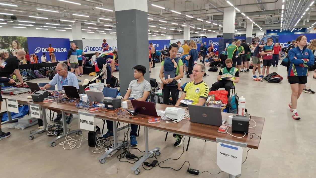
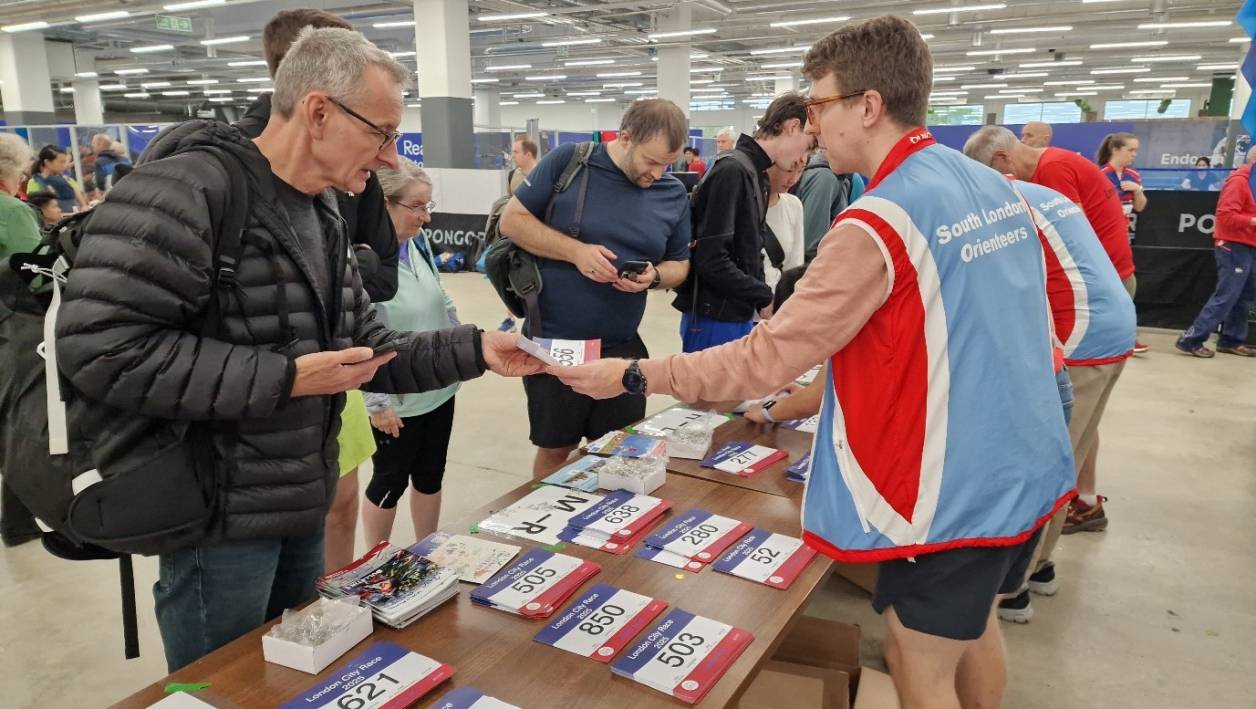
Images below: SI hire and download, over 900 bibs to issue.
And Andy, as this year’s organiser, please can you outline the process and give a brief overview of what it is like coordinating a race that is part of the Euro City Tour? Helen, is there anything you would add to this?
Andrew Trimble, SLOW
We welcomed orienteers from all over Europe as part of the Euro City Tour. It is possibly one of the biggest, in terms of numbers, urban orienteering races. There were also races in Greenwich Park (DFOK) on Friday evening and on Hampstead Heath on Sunday (LOK) to make it a worthwhile visit to London.
Initially we planned to use Wapping as the race area.. Unfortunately, my negotiations with Tower Hamlets Council proved to be too difficult to conclude to their satisfaction about the locations of the controls. Due to this and the potential high costs we switched at the end of July to our back up area, Rotherhithe, with Decathlon as our event centre. This proved to be an excellent location but put a lot of pressure on our planner Gordon to update the map and replan all the courses in time. We may go back to Wapping in the future. The history of this riverside community on the north bank of the River Thames is fascinating.
What were your highlights from the event overall?
As far as we know we had no complaints from runners or from the local community. This is a considerable achievement in a dense urban area. All SLOW helpers who wanted to run were able to do so.
Did you receive any useful feedback from competitors on the day?
The London City Race is always my favourite event of the year: there is something unique about running round our wonderful capital city, with its amazing landmarks, variety of residential areas and pockets of parks and woodlands, that make the event such an experience. It even inspires interest from work colleagues and non-orienteering friends alike. It was therefore an absolute pleasure to control the LCR this year. Gordon, Andrew, Alan, Don and the rest of the SLOW team were outstanding, which meant there was very little for me to do beyond casting a second pair of eyes over everything and checking no “i”s had been left undotted or “t”s uncrossed. No mean feat at the best of times, let alone after relocating the event with just 7 weeks to go!
From the comments I heard at the finish on the day, I’d say Gordon’s courses provided that exact mix of enjoyment and challenge folks were expecting – well done all. Helen Marsden (Controller)
Is there anything you would have done differently looking back on this year’s event?
We should have made a call on the use of Wapping a bit earlier – it was a tricky balance as we believed progress was positive. This would have allowed entries to open earlier, particularly to allow competitors to avail of cheaper flights and trains and also would have taken some pressure off the planning and mapping.
We have provided an Accessible course for three years now. We would like some help in Accessible course publicity to try and grow these numbers and make the sport fully inclusive. Sponsorship to enable the event to grow would be helpful.
What would you say to someone who is relatively new to their local orienteering club, and may not yet have had the confidence to sign up to one of these races?
Urban is a completely different way of doing orienteering from the forest. It is often quite flat and navigation through alleyways and steps quite tricky, a different kind of challenge. See if you can find a local urban event and give it a go.
Please include the results from this year’s competition.
London City Race 2025 Results – South London Orienteers
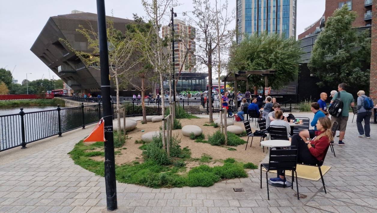
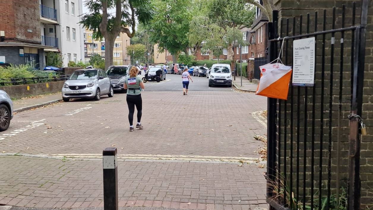
Images below: Spectator at the last junior control overlooking Canada Water, start kite at King George Gardens, straight out onto the urban environment. Don’t miss that alleyway on the right.
Are there any people in particular you would like to thank for helping to ensure that this year’s event was a success?
I want to thank over 40 SLOW members turned out to help for our biggest event of the year. It was a big team effort. However, 3 people stand out for special thanks, Gordon (planner), Alan (weekend coordinator) and Helen (controller). The late change to Rotherhithe went very smoothly due to all their hard work.
Can you explain, in your own few words about the importance of volunteers at larger-scale events such as city races?
There were four key areas, pre-race mapping and planning, second - getting all the controls out and back, thirdly - setting up the bibs and SI downloads in the event centre, and fourthly running the start for over 900 competitors in a 3 hour start window. This takes a lot of volunteers, most of whom wanted to run, so we had overlapping shifts. We were also able to offer all volunteers free entry.
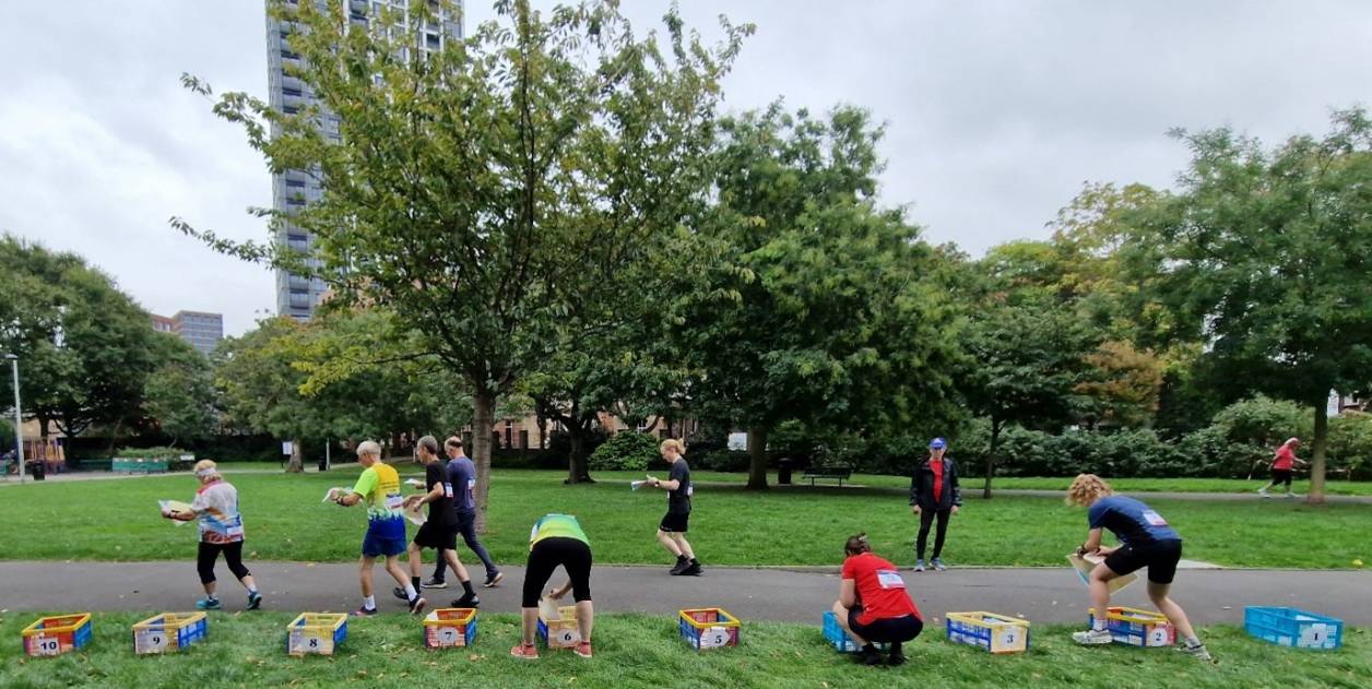
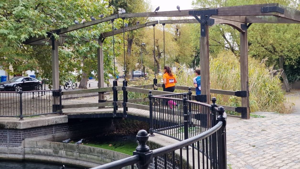
Images below: 14 start boxes with the maps for each course, mid race running over the little bridge, but was it the best route?
More Blog Posts
GB Squad heads to Hungary for pre-WOC 2027 training camp
27 July 2026

Orienteering safely around dogs (your own or other people’s)
9 July 2026