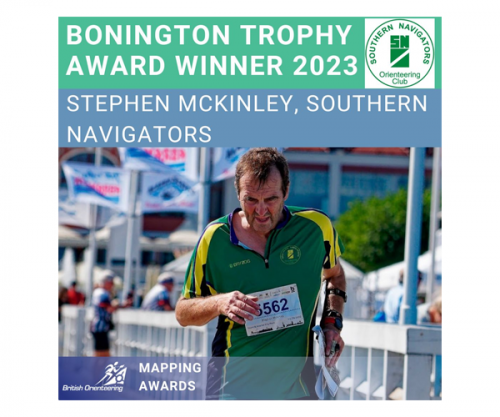
Bonington Trophy Award Winner 2023: Stephen McKinley, Southern Navigators Orienteering Club
28 March 2024
We are delighted to share that the winner of the Bonington Trophy Award 2023 is Stephen McKinley from Southern Navigators Orienteering Club!
Here, we share what his nominators had to say about his contributions to mapping a multitude of areas including Long Valley South, Wellington College, Cove Brook and the wider Farnborough area and more.
The Bonington Trophy was donated to British Orienteering by its Honorary President, Sir Chris Bonington, the world-famous mountaineer. It is awarded annually for the 'best contribution to mapping' which can cover a whole range of activities related to mapping.
Stephen McKinley, Southern Navigators Orienteering Club
Map area: Multiple locations including Long Valley South, Wellington College, Cove Brook/wider Farnborough area, Rodborough Common and Puttenham Golf Course.
Steve has been Southern Navigator’s (SN) Mapping Officer for many years and is responsible for maintaining and updating the club’s library of current maps and coordinating the production of new maps. Steve undertakes much of the cartography and survey work himself on a voluntary basis.
This nomination is particularly for Steve’s work in recent years. He has instigated a rolling programme of updates to bring SN’s maps into line with the latest mapping specifications, newly acquired LIDAR data, and accurate geo-referencing. This has ensured a consistency in style and presentation and has only been possible due to Steve’s commitment of considerable amounts of his “spare” time to maintain and improve the club’s most valuable assets.
Whilst LIDAR can be used to obtain accurate contour and vegetation data, significant interpretation and simplification are required before the LIDAR information can be converted to an orienteering map that is clearly laid out and easy to read. Combining his mapping skills and experience, with his knowledge of OCAD software, Steve has used his skills to make maps that are relevant and helpful to a competitor. The results of Steve’s work can be seen on maps used at all levels of events and activities. Within the last three years alone, examples of Steve’s mapping updates, new maps and base maps could be seen at:
· Long Valley South (SN Trophy 2022) and Mytchett (SN Trophy 2023): national events on varied and complex terrain with numerous vegetation and contour features
· Wellington College (SCOA League event, Dec 2022) and Frensham Heights School: areas of school campus, sports facilities and surrounding woodlands drawn to sprint specification
· Cove Brook/wider Farnborough area (used for SEOUL Urban League races in 2022/23): classic urban terrain where clear and accurate cartography is essential to enable fair assessment of permissible routes and uncrossable boundaries
· Rodborough Common: a new map of small local forest/heathland terrain used for Level D club events and training activities
· Puttenham Golf Course: used for night orienteering training
· Significant LIDAR-based updates to several other SN areas used for Level D events (e.g. Farnham Park, Witley Common, Southwood)
Southern Navigators are not the only club to benefit from Steve’s work. He provided interpreted and simplified LIDAR base maps to our neighbouring clubs BAOC (Ash Ranges and Frith Hill) and BADO (Kings Worthy and South Ham and Buckskin Estates), enabling quality updates of these areas.
The examples above illustrate how Steve’s mapping skill has been applied to all types of terrain for different levels of events and has supported literally thousands of individual participants every year.
Within the extensive list above Steve has personally done ground survey work for Long Valley South (2022 update) and Rodborough Common (new map) and has checked out many general update requests from the club’s Planners as each area is re-used.
Never one to sit back, Steve has continued to look for new areas and initiatives which may benefit SN and orienteering more widely. In 2023, a local charity approached SN, which resulted in Steve generating a new LIDAR-based map of Woodlarks camping ground for the disabled, thus making orienteering accessible to disabled people. Steve is currently updating the Hindhead Common map which will be used in February 2024 for an event in conjunction with a National Trust supporters’ group which will provide the opportunity for the ‘supporters’ to try out orienteering on an area which they already know and love.
In summary, this nomination reflects Steve’s dedication and skill over many years, producing high-quality maps to enable Southern Navigators to stage high quality and enjoyable events.
Congratulations to Stephen on receiving the Bonington Trophy 2023.
_______________________________________________________
It’s important to us, to recognise the other individuals who were nominated for the Bonington Trophy 2023. Here they are, alongside some of the comments regarding their contributions over the past year.
Nominations for the Bonington Trophy 2023
Martin Hore, Suffolk Orienteering Club – Map area: Suffolk maps
“Martin took over the lead in mapping for the club nearly a decade ago having been making maps for some time. In recent years he has pushed ahead developing new techniques to make new maps - and revise older ones - so they are geo-located. He has explored the freely accessible data that can enhance mapping making significant use of Lidar and aerial imagery to pin down the tricky humps and hollows in locations like Bridge Wood, Ipswich.
Alongside producing quality mapping, he has also taken time to bring on other mappers: encouraging skill development for experienced folk and starting from basics for newcomers. He is always ready to listen to feedback from all types of users - landowners to planners to competitors - meaning he acknowledges that the mapping can still improve.”
Alasdair Pedley, Auld Reekie Orienteering Society – Variety of locations including Sprint Scotland and EUOC Big Weekend
“Alasdair has mapped for Sprint Scotland, EUOC Big Weekend, coast and islands and a EUOC/ AROS sprint relay. Outstanding quality of mapping for his age. He always takes advice and is happy to pass it on. He has also collaborated with Chris Smithard and Graham Gristwood on projects.”
Rod Postlethwaite, Wrekin Orienteers – Map area: Woodside
“A very complex area, superbly mapped by Rod using all his 40 years of mapping experience during which time he has mapped many areas for WRE including using recent innovations such as LiDAR.”
_______________________________________________________________________
Next up, we will be sharing details of our Chichester Trophy Winner 2023. Check our website or social media daily for the latest updates.
Latest News
British Orienteering launches Youth Voices Programme
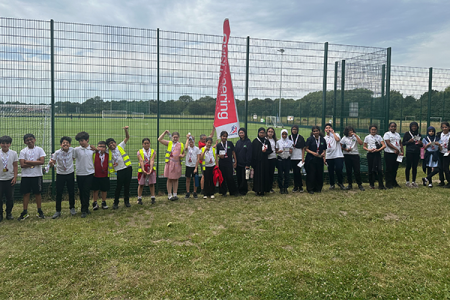
Young People Discover Orienteering at Hough End as Part of National School Sports Week