
This form of Trail Orienteering became very popular as a result of the near-closedown of 'real' competition because of the Corona epidemic. Both PreO and TempO can be presented virtually, using photographs of terrain with either real flags or computer-generated ones, together with map sections at 1:3000 or 1:4000, usually but not necessarily in Sprint (ISSOM) format.
TempO is the most common format, and the TORUS competitions (http://torus.yq.cz/) promoted by Libor Forst, Czech Republic, are the most prestigious, have the highest quality and are the most popular. In 2020 and 2021, two series of full-length (6-7 stations) events were held on Tuesdays and Thursdays, one in the spring and one in the autumn. In addition in 2020 there was an Advent Calendar consisting of 24 2-3 station events in 24 days in December, and in 2021 a series competition from Sweden early in the year. There are now, in 2023, fewer events taking place but they are still challenging and provide useful experience of varied terrrains
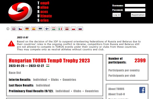
The home page of TORUS.
In many TORUS events there have been 2 classes: Advanced and Basic (originally called Beginner). You have to register for TORUS on the website, but everything is free of charge.
How to compete
The standard format of a station in Virtual TempO starts with a photograph of urban, park or forest terrain with 6 flags (A to F, left to right) in view. After 2-3 seconds, the first task comes on screen, with the photograph, map extract and control circle, control description, and six answer buttons (A to F, and Z where there is no flag at the location shown by the control circle). The task is to decide which, if any, of the 6 flags is sited precisely at the location shown by the control circle on the map. Here is an example screenshot:
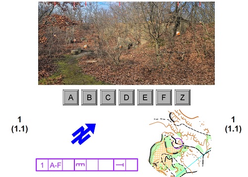
Notice that you also have to decide where the image was taken from - this is not marked on the map. You choose your answer as quickly as possible; your time taken is recorded by the computer software. Task 2 then comes on screen, with the same photograph but with a (maybe slightly different) map segment with the control circle in a new location, a new control description, and the buttons. Again you choose your answer quickly, and continue in the same fashion to complete five tasks in all.
Your answers and your total answer-time for the station are recorded automatically, and you can then move on to the next station, with a different photograph, when you are ready.
At the end of a TORUS event, your position in the results list to date appears on screen, after a short delay. Full results are published after the event is closed, and you have the opportunity first to see your own result, showing the tasks you got right and wrong, and you have the opportunity to look at the problem (photo and task map) again, together with a station solution map. Then you can key to see the full results list and your position within it; all answers for all tasks at all stations are shown.
Practice
The TORUS website has many practice events available at all standards from Novice to Advanced, and you can also work through all previous competitions. So there is every opportunity to get fully used to the format and do some training before entering a specific competition.
TORUS is not the only version of Virtual TempO available, and other opportunities are usually publicised on the Facebook pages 'Trail Orienteering' and/or 'Bearing towards the C-Flag'.
PreO
A standard PreO event can also be presented in Virtual form, and for example Akune Li, Hong Kong OC has produced a number of PreO events on Hong Kong and Taiwan terrain with up to 36 controls, providing Google Street-map viewing of the terrain from all points along the route, together with the competition map showing the course and the control description list. These are also a good - and lengthy - challenge with good terrain-reading skill required for success. Excellent for training map-reading and map-to-terrain skills!