Example Annotated Orienteering Maps
This page will provide landowners with example maps that have been specially created for orienteering events and activity. These maps are annotated, in order to help a landowner understand what the colours and symbols represent, and highlight the great detail that these maps go into.
Background: Orienteering Maps
Maps for orienteering are specially curated, to include the level of detail that orienteers require in order to read the terrain and understand the area that they are orienteering in. Maps are drawn on a magnetic north, and use a range of colours to represent land forms, vegetation, buildings and open land.
The colours are an integral part of the map symbols:
- Black is used for most man-made features such as buildings and rock features such as cliffs, crags and boulders.
- Brown is used to show landform, including contour lines, gullies, pits and knolls (small hills).
- Blue is used for water features such as lakes, ponds, marshes and streams.
- White and Green are used to depict the density of woodland and the extent to which it impedes progress. Open ‘runnable’ woodland is left white with progressively darker shades of green meaning increased density.
- Yellow is used for unwooded areas with a solid yellow for grassy spaces such as playing fields and a paler yellow for rougher terrain (‘rough open’) such as heather.
- Combinations of Yellow and Green show other types of terrain which will be explained in the legend.
Here are two example maps, one is an example of a terrain area, and the other is an urban area, of which part crosses into a university campus.
Terrain map
This is an example of a terrain map, with the annotations highlighting different aspects of the area. It is important to note the purple hashed areas, as these indicate out-of-bounds on the map. This means, under no circumstances can competitors cross these areas whilst out on the course. Clubs are able to and are very willing to work with landowners around out-of-bounds areas, and can be implemented on the map to ensure the avoidance of particiular sections of an area.
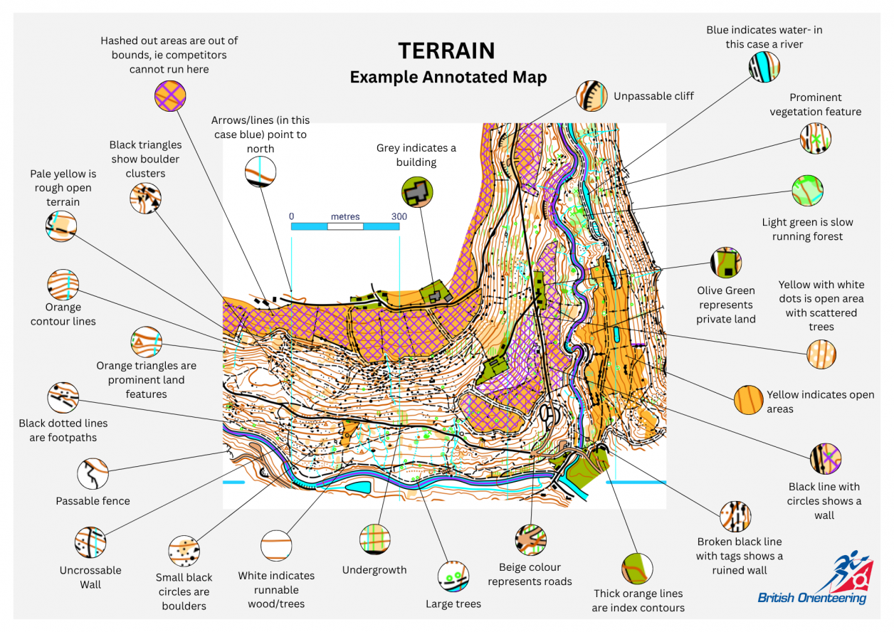
Many thanks to PFO for allowing us to use their map.
Urban Map
This is an example of an urban, as you can see, this looks very different to the terrain example above. This is extremely detailed around the buildings, roads and paths. Even canopies between buildings are mapped.
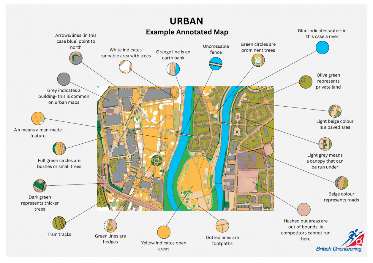
Many thanks to SELOC for the use of their map.